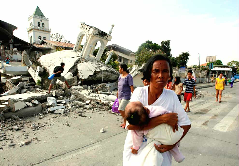
It has been twelve years since the violent 7.2-magnitude earthquake struck Bohol on October 15, 2013, one of the most devastating disasters to hit Central Visayas in modern times.
The quake left more than 200 people dead, injured hundreds, and damaged over 70,000 homes. Historic churches, bridges, and roads collapsed. The impact extended beyond Bohol, Cebu also suffered casualties and heavy structural damage, proving that the tremor’s reach went far beyond one island.
Now 12 years after, another major earthquake shook the region, this time a magnitude 6.9 quake centered in Bogo, northern Cebu. Though slightly weaker, it caused significant destruction in Bogo, San Remigio, Medellin, and nearby towns, where over 70 lives were lost and thousands of homes were damaged. Yet unlike the Bohol tragedy, the casualties were mostly confined to a handful of northern Cebu towns, not across multiple provinces.
Interestingly, the Bogo quake revealed a surprising geological feature , an alarming number of sinkholes, especially in San Remigio where more than a hundred were discovered. In contrast, the Bohol earthquake was more known for the dramatic rise of the North Bohol Fault or “Great Wall of Bohol”, rather than sinkholes. This shows that while both disasters shared the same regional fault system, their surface effects were remarkably different.
The Bohol earthquake remains the more powerful and widespread of the two, claiming more lives, damaging heritage churches, and leaving a deep scar across Central Visayas. The Bogo quake, on the other hand, stands out for its localized devastation and unusual geological aftermath. Both serve as painful reminders that the Visayas lies along an active fault zone, and that preparedness remains the best defense against the earth’s next violent awakening.